Page last updated on April 5, 2019 at 10:50 am
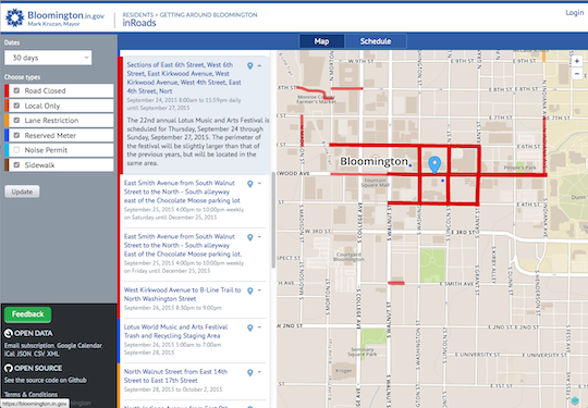
inRoads is a digital service for managing and publishing road, sidewalk and parking status information. inRoads is running at https://bloomington.in.gov/inroads. The information shared on the inRoads service includes closings, lane reductions, noise permits and parking reservations. It provides not only current information about road events, but future planned events as well. inRoads streamlines the process of creating and managing road, sidewalk, parking and other location-relevant municipal events (noise permits, etc.). inRoads publishes its data to the web, to email lists and to multiple open data formats. Our deployment of InRoads is used by the City of Bloomington, Monroe County and Indiana University. An inRoads data feed can be provided to publish road closing information into Waze via its Connected Cities program.
Open Source
inRoads is an open source PHP application developed by the City of Bloomington. The interface levers the Open Layers library for rendering the map, and custom Javascript routines for interactive elements on the client side. The application also uses Google's Calendar service to assist with filtering and retrieving relevant events. The code is available via GitHub at https://github.com/City-of-Bloomington/inRoads.