Page last updated on December 8, 2020 at 1:05 pm
For more information, please contact
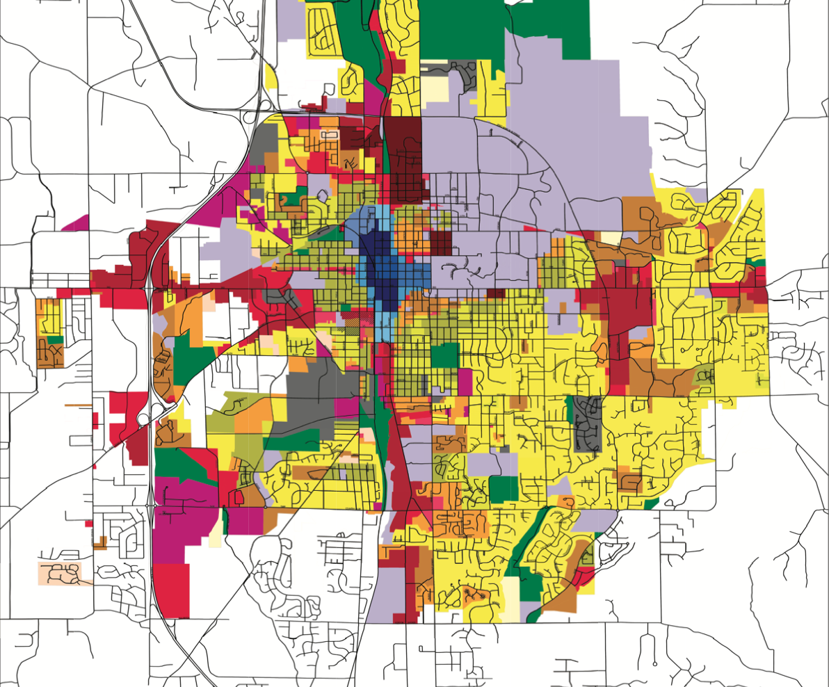
New Draft Bloomington Zoning Map Released for Resident Input
Bloomington, Ind. - A draft of the proposed new Bloomington Zoning Map has been published to the City’s website as a step in the last phase of the process of updating the Unified Development Ordinance (UDO) and Zoning Map, which began nearly three years ago in February of 2018. Approved in April 2020, the UDO brings the City’s land use and development laws into closer alignment with the City’s 2018 Comprehensive Plan to support such goals as housing equity, compact urban form, and sustainability.
The website contains the public outreach draft map and amendments to UDO standards, a proposed zoning changes story map, proposed housing diversity story map, an interactive map where residents may enter their address, and information about opportunities to provide feedback over the next eight weeks. The input collected during this period will help staff prepare for public hearings in early 2021 to consider and adopt the new zoning map for the city, along with text amendments.
The first public engagement session will take place via video conference from 5:30 p.m. to 7 p.m. on Tuesday, October 27. (A link to join the meeting will be posted at the project website.) The meeting will feature a presentation of the proposed changes with the largest impact with a short facilitated question-and-answer session after the presentation. There will be at least four meetings over the course of the next month to gather public input. Residents may also provide feedback through online surveys on the project website.
“Our land-use choices are crucial in advancing our community toward more sustainability, equity, economic viability, and an ever-improving quality of life for people from all walks of life,” said Mayor John Hamilton. “These choices are complex and interconnected. I encourage residents to participate in the ongoing process of developing a new zoning map that best embodies our community’s fundamental values.”
The public outreach draft map was developed by analyzing existing conditions (e.g. lot standards) and putting principles contained in the Comprehensive Plan into action, by fostering economic growth, increasing housing options, locating student housing in appropriate locations, and encouraging land use that increases alternative transportation options. The draft map also seeks to modernize outdated Planned Unit Developments (PUDs), in order to simplify and efficiently steer development in those areas.
When adopted in April 2020, the UDO included a Conversion Map with new zoning district names, standards, and uses for existing districts without altering the location of those districts and without adding any new districts. In that way, the community was able to discuss the broader themes and technicalities of the UDO without simultaneously tackling the discussion of where the districts should be located. The Zoning Map update will complete the process of identifying these locations.
The public outreach draft map and text amendments include the following significant proposed changes:
-
Identifying locations for three new Zoning Districts described in the 2020 UDO:
-
PO: Parks and Open Space
-
R4: Residential Urban
-
MS: Mixed-Use Student Housing
-
-
Identifying 20 individual areas for targeted rezoning
-
Rezoning the following ‘Focus Areas,’ that is, locations that are expected to see the most immediate or anticipated development/redevelopment interest over the next decade:
-
West Fork Clear Creek: areas including Sudbury Farms and Mill Creek PUDs
-
Switchyard North and Gateway South: areas surrounding Switchyard Park and south of downtown
-
West Second Street Hospital Redevelopment Site
-
Gateway North: areas north of downtown
-
-
Identifying over 100 PUDs for rezoning
-
Adding "plexes" as a housing options in all districts that allow residential uses
Ongoing updates to the project website will include responses to input received, informational presentations, draft text amendment revisions, and the next steps for the adoption process of the new Zoning Map and text amendments. Residents are encouraged to visit the website often for the most updated information. After the eight-week public input period, staff will consolidate the comments and make appropriate changes to the draft map and text amendments in order to present the map and public input to the Plan Commission in early 2021. After Plan Commission review and approval, the changes will be presented for City Council action.

