Page last updated on January 2, 2026 at 2:56 pm
REQUEST FOR UTILITY MAPS
Contact our Assistant GIS Coordinator via phone (812-349-3620), or email us to request a digital map.
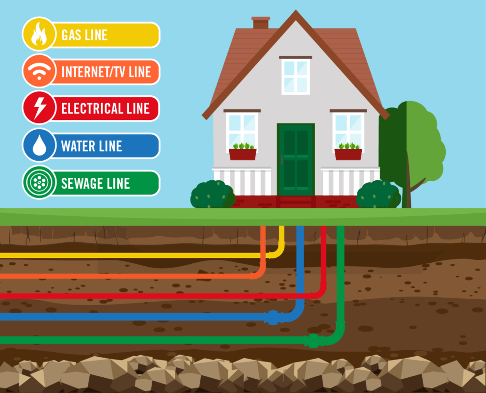
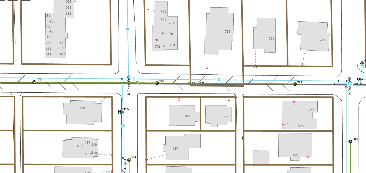
CBU does not maintain records for Electric, Gas, Cable/Fiber, or any other utility infrastructure other than Water, Sewer, and Stormwater within our jurisdictional service territory. Below is a sample GIS map and basic Legend for how to read the map once it has been provided. All utility locations indicated on the map are for reference only. (See full disclaimer below)
WATER:
- Light blue lines are CBU water mains and hydrants.
- Red circles are the approximate location of the water meter. The dashed line from the water meter to the house is only for referential purposes to indicate which meter belongs to which house and does not indicate the path of the private water service line.
- Dark blue lines are Private water mains and hydrants (generally all behind a master water meter).
SEWER:
- Green lines are CBU sewer mains and manholes.
- Black lines from the green sewer main pointing toward each building is the sewer lateral's connection to the sewer main. The sewer lateral is only an approximate location and direction leading from the main. Should you need specific footage data for the sewer lateral's connection point on the main, please include this information in your email request.
- NOTE: The line is indicative of the customer's private service line and is only used as a reference to know which building is connected to the sewer main at a specific location. The path of the lateral is unknown and the customer's responsibility to locate and maintain.
- A solid red line is a private sewer pipe and requires both CBU and Owner approval prior to connection to this line.
- Orange lines are force mains that connect to lift stations & homes to gravity-fed sanitary sewer lines in areas that are not able to gravity-flow directly to sanitary sewer mains.
STORMWATER:
- Magenta/purple lines are CBU stormwater infrastructure (inlets/pipes)
- Coral lines are private stormwater system...generally a ditch line or other installed infrastructure on the property which is maintained by the customer/owner, or is outside of CBU’s jurisdictional area.
The infrastructure indicated on all maps provided by CBU is for referential purposes only and must be located in the field for exact location prior to planning, digging, or construction. The public portion of the utilities (mains to meters) can be located by calling 811 or going on to their website: https://indiana811.org/ to complete a ticket request. This service will not locate the private portion of the utilities on the property (meters to house or other service sources such as a lawn sprinkler, electric to outbuildings, etc).
Locating the private portion of utilities MAY be able to be done by hiring a private utility locator. You can find out more information about homeowner’s private utilities from the 811 website at: https://indiana811.org/myutilities/. CBU is not affiliated with any of the companies on this site, and may not recommend any one over another; this website is being provided for informational purposes only. Hiring someone for this service is strictly up to the property owner and at the owner's expense.
Planning a Project?
If you are planning a project on your property, please visit our plan submission requirements page to see if your project type will require submission of plans to CBU for review. Often times even minor projects also require permits from either the City of Bloomington Planning Dept or the Monroe County Building Dept. Please refer to those departments to verify that your project is good to go before starting.
Website Links:
CBU Plan Submission & Project Types
City of Bloomington Planning Department
Monroe County Building Department
CBU is able to provide shape files upon request for larger project planning purposes.
Please contact our GIS Coordinator at 812-349-3622 for more information.